Hiển thị các bài đăng có nhãn Twin Cities Area Trails. Hiển thị tất cả bài đăng

Thứ Sáu, 8 tháng 1, 2016

Twin Cities Area Winter Fatbike Trail Opportunities


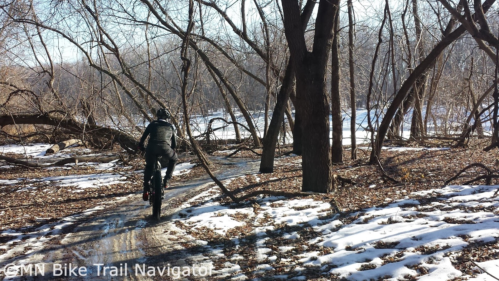
Winter fatbiking is big in Minnesota and the Twin Cities have quite a few trail systems that are groomed or snowshoe stomped by volunteers to pack the trails for riding.  With the ever increasing popularity of  these wide low pressure tire bikes, new trail riding opportunities have popped up.  I have compiled a list of these trails open to winter mountain biking with links to maps, trail information, trail conditions and Facebook/Twitter pages if available.  Trails that have Facebook or Twitter pages will post trail openings and conditions or closures due to warm weather.

Low tire pressure, usually 10 psi or lower and tires 3.8 inches or wider are recommended for use on these trails in the Winter.  Skinny tires can be used when trails are firmly packed enough to not cause ruts or damage.

Image Credit: Bertram Lakes Singletrack Facebook Page
Bertram Chain of Lakes
Monticello
Map     Trail Info     Facebook  

Winter fatbiking is allowed but please stay off the cross-country ski trails.  Group ride information can be found on the MORC Group Rides Forum and the MN Fatbike Group Rides Facebook group.

Image Credit: Brookview Golf Course website
Brookview Golf Course
Golden Valley
Facebook

Brookview Golf Course has multi-use trails that are open to fatbiking for the second year.  Fatbike rentals are available and the Fattyshack grill is open on weekends serving up food and cocktails.  For more information see the City of Golden Valley's recent article.
Carver Lake Park
Woodbury
Map     Trail Info     Facebook  

Carver Lake Park is host to the Cold Catfish Cup that takes place January 24th.  Watch the MORC Racing Forum for updates.  Group ride information can be found on the MORC Group Rides Forum  and the MN Fatbike Group Rides Facebook group.

Image Credit: Three Rivers Park District
Cleary Lake Region Park
Prior Lake
Map     Trail Info     Facebook

Cleary Lake Regional Park in Prior Lake grooms trails for cross-country skiing and according to Explore Minnesota it also has a "fat tire" trail with bike rentals available during the winter.  Call Cleary Lake Regional Park (763-694-7777) for more information.

Elm Creek Park Reserve 
Maple Grove
Map     Trail Info     Facebook

Elm Creek is home to the Fatbike Frozen 40 taking place on February 13, 2016 and two of the the four races in the Frozen Frolic Winter Mountain Bike Race Series.  Group ride information can be found on the MORC Group Rides Forum and the MN Fatbike Group Rides Facebook group.

Image Credit: Bonnie Moebeck
Fort Snelling State Park 
Maple Grove
Map     Trail Info     Facebook

The Minnesota DNR added 6 new miles of packed multi-use trails last year as part of its Winter Fat Biking Pilot Project

Credit: Mistermoose.org
Hillside City Park* 
 Elk River

Hillside is home to FatBikeFest taking place on February 28th.  Watch the MORC Racing Forum for updates.  *Day Pass fee required.
Lebanon Hills Regional Park-West 
Eagan
Map     Trail Info     Facebook     Twitter
 

Check in with the Lebanon Hills Mountain Bike Trail Facebook page for trail openings and closures from Dakota County Parks due to weather.  Group ride information can be found on the MORC Group Rides Forum and the MN Fatbike Group Rides Facebook group.

Mendota Trail (MN River Bottoms) 
Eagan

This multi-use trail has access points in Eagan at the Cedar Ave. bridge and in the town of Mendota.  It follows the Minnesota River through Fort Snelling State Park and access to the Minnesota River Bottoms on the North side of the river can be done by taking the pedestrian bridge on the Cedar Ave. bridge.
 
Minnesota River Bottoms 
Bloomington

The 4th Annual Get Phat With Pat Winter fatbike races will be held at the Minnesota River Bottoms on January 23rd and January 30th.  These races will include new and challenging groomed trails through sections of the Minnesota River Bottoms you don't normally get to ride through.  There are several weekly group rides held here and more information can be found about them on the MORC Group Rides Forum and the MN Fatbike Group Rides Facebook group.

Image Credit:  Deathrider
Murphy-Hanrehan Park Reserve 
Savage

Murphy-Hanrehan hosts two of the the four races in the Frozen Frolic Winter Mountain Bike Race Series.  Group ride information can be found on the MORC Group Rides Forum  and the MN Fatbike Group Rides Facebook group.

Salem Hills/Harmon Park Reserve
Inver Grove Heights
Map     Trail Info     Facebook


Credit: Minneapolis Off-Road Cycling Advocates Facebook Page
Theodore Wirth Park 
Minneapolis
Map     Trail Info     Facebook     Twitter

The mountain bike trails at Theodore Wirth Park are monitored and maintained by MOCA volunteers.  Closures and trail conditions can be found on the MOCA website in the upper left-hand corner of the page and rider reports are listed on the Theodore Wirth MORC Trail Conditions Forum page.

Other informative Twin Cities mountain biking links can be found below and remember to always follow IMBA's Fat Bike Best Practices to maintain and gain more trail access and give our sport a good name.

MORC-Minnesota Off-Road Cyclists
Minneapolis Off-Road Cycling Advocates

For a complete listing of this Winter's fatbike events, see my post Winter '15-'16 Minnesota Fatbike Events.

Bookmark this post for quick reference. 

Chủ Nhật, 13 tháng 12, 2015

Singletrack Alternatives to Continue Riding During Freeze/Thaw Periods


The unusually warm December weather we are experiencing has put us in a freeze/thaw cycle closing many of the singletrack trails around the state.  To keep the legs fresh and still get some miles in the saddle on a regular basis I have put together some places to ride until the snow comes offering us some groomed singletrack.

Gravel

If it's one thing Minnesota has plenty of it's gravel.  With an ever growing list of gravel rides and races throughout the year, you're sure to have plenty of route options following one of these courses. If you're new to gravel, Gravelmap.com will help you find roads to ride.  I have also posted some of my favorite gravel rides on MN Bike Trail Navigator complete with maps, cue sheets, gpx file download links and Strava route links.  Gravel never closes and is a great way to get in some miles with varied terrain and climbing.

Aggregate Trails

Minnesota has several aggregate trails that are similar to riding gravel.  Most are built on former railway beds so there won't be much elevation change but they will allow you to get in some miles, none the less.  Some of these include the Luce Line State Trail, Minnesota River Bluffs LRT Regional Trail, Lake Minnetonka LRT Regional Trail.

State Trails

Several of Minnesota's State Trails have a natural surface treadway suitable for horseback riding or mtb/fatbike use.  If sharing the trail with horseback riders please use proper trail etiquette.  These trails include:

 
River Bottoms Bushwacking

River bottoms floodplains have some great riding opportunities.  Two of the areas I have done some "bushwacking" are the Vermillion River Bottoms and the Minnesota River Bottoms.  Bushwacking is riding through areas where there is no trail and river bottoms floodplains are a great place to do this.  Fall and early Winter are great times to ride these areas of flat wooded expanses.


The Mississippi National River & Recreation Area near Ravenna TWP southeast of Hastings along the Vermillion River is definitely worth exploring.  The Minnesota River Bottoms is also a good place to roll through floodplain forests and fields.  Respect the area you ride and remember to leave no trace.

Forest Service/Logging Roads
Image Credit: Joe Sacco

The Chippewa National Forest and Superior National Forest have plenty of Forest Service roads, logging roads and unpaved trails with some beautiful scenery to be explored.  Some of these areas are remote so make sure you have everything you need to get you out of a jam and back to where you started.


State Forests
Image Credit: Joe Sacco

Minnesota State Forests are also full of riding opportunities.  These opportunities include non-motorized trails, multi-use trails, State Forest roads, Minimum Maintenance Forest Roads and OHV/ATV trails.  Below are links to maps and more information on these State Forests.

Southern MN State Forests


Central MN State Forests

Northern MN State Forests
Pillsbury State Forest     Map       

The Minnesota DNR reminds you, when biking in State Forests:
  • Mountain biking is permitted on all state forest roads and trails unless posted closed with the exception of Richard J. Dorer Memorial Hardwood State forest, where mountain bikes are permitted only on designated trails.
  • State forest roads can range from asphalt to gravel, maintained to minimal maintenance road surfaces.
  • Forest roads are used by cars, logging trucks, and other forest users (hikers, hunters, horseback riders, ATVs, and off-highway motorcycles).
  • All laws for public road use must be followed on state forest roads.
  • Watch out for logging trucks and heavy equipment in a state forest.
  • Check the state forest maps and Web site for road and trail closures.
  • Share the trail with others.
  • Stay on designated trails.
  • Keep right so others can pass.
  • Keep all pets on leash.
  • Obey traffic signs and rules.
  • Pack out all garbage and litter.
  • Respect adjoining landowners’ rights and privacy.
  • Warn other trail users when passing by giving an audible signal.
  • Let horses know you are passing. Some may be spooked by quiet bikers or inline skaters.
  • Overnight camping and campfires are permitted only on designated campsites.
  • Do not leave campfires unattended.
  • Enjoy the beauty of wild plants and animals, but leave them undisturbed for all to enjoy.
For more information on mountain biking in Minnesota State Forests, see my post, Explore Minnesota's State Forests by Mountain Bike With Resources From the MN DNR.

To order a State Forest map, contact the Minnesota DNR Information Center.

Phone:  651-296-6157 or 888-646-6367
Email:   info.dnr@state.mn.us
Address:  500 Lafayette Road
St. Paul, MN 55155-4040

Paved Trails

Paved trails are always open and many of them in Minnesota have some great scenery.  For a list of trails throughout the state of Minnesota with links to more information and maps visit the appropriate MN Bike Trail Navigator trail links page for your area.


MN Fatbike Enthusiast Recommendations 

I received several recommendations from MN Fatbike Enthusiasts Facebook Group members when posed with this question "...places to ride for mountain bikers/fat bikers during this freeze/thaw period that we are in. With the trails closed, where are you guys riding to get miles in?

"7 mile creek park in Nicollet county...located off Hwy 169 between Mankato and St. Peter. Their multi-use trails have gravel and are always open." - Clay Haglund

"Road bike on the trackstand, and fat-bike at Wayside Prairie and Dalbo Memorial Forest County Parks. Both dry off quickly after rain do to heavy pine cover." - Hans Erdman

"The MRT trails in St. Paul along the river. I've been doing lots of 'urban exploring'. I've also ridden some gravel out towards Rosemount." - Tony Lema

"All early morning rides...... Forest road/woods/mining areas, frozen gravel. Paved trails..... anywhere but established sweat earned single track goodness.... that will come next week!!" - Joe Sacco

"Gateway Trail heading towards Pine Point park (don't ride in Pine Point). Lots of horse trail and singletrack there . All sand and good water wicking dirt and back." - Papito Gregorio

"Soo Line Recreation Trails in Central MN. (Approxiately 50 miles one way of trail). Lots of minimum maintenence roads that connect to these trails. Several county parks, forests, and some state trails. Check out Stearns County Recreational Trails for a list of fat bike friendly locations. I would suggest get a hold of your local bike shops, trail advocates, and bike clubs for a complete list of fat bike friendly routes. Then there is lots and lots of gravel roads winding through the country side. Several turn into minimum maintenance roads. Get up to Central MN and "get your fat on"." - Theresa Gregory

Hopefully this post will give you some ideas of where to ride so you can keep getting miles of riding enjoyment in until the singletrack trails open once we get some snow and below freezing temperatures.

Chủ Nhật, 22 tháng 11, 2015

Get Phat With Pat Winter Fatbike Races Return to the MN River Bottoms in January


Penn Cycle & Fitness will hold the Get Phat With Pat Fatbike Races for the fourth year at the Minnesota River Bottoms in Bloomington on January 23rd and 30th.  They are co-sponsored by and are a part of the Bloomington Winter Fete.

The Details: 

Both races will be held at the Russell A Sorenson Landing at the end of Lyndale Ave. S. in Bloomington, MN underneath the 35W bridge.  Registration will start and 9 am the morning of each race and closes 30 minutes prior to race start. Registration will require a $10 entry fee and also a $5 donation to MORC (Minnesota Off-Road Cyclists) which will help the non-profit volunteer organization pay for trail maintenance, equipment and fund their 2016 season.


Fat bikes (3.8” tires and wider) are recommended. Depending on course conditions and entries, there may be a separate class for non-Fat-Tire bikes. Spectators are encouraged and welcome!  There will be three race classes for each race day; Beginner, Recreational and Advanced.  The Beginner class race will start at 10:15 am and consist of one lap, the Recreational class race starts at 10:00 am and is two laps, the Advanced class race starts at 12 noon and will be three laps.


The race course will be similar to last year's race with a new section in the East segment that lies between Lyndale Avenue and Cedar Avenue.  Start and Finish will be under the 35W bridge with the course heading West before turning around near Nine Mile Creek for an additional loop East of the Lyndale Ave. parking lot.  The lap will be a loop of about 6 miles with one section of trail heading out and another heading back.


An agreement with the City of Bloomington will allow many temporary sections of trail for the races.  The race course will be groomed and ready to ride one week before the first race.  Riding the temporary course once established is encouraged to pack down the trail.


Prizes will be awarded to the top three male and female finishers in each category.  There will be plenty of swag given away to race participants at the conclusion of each day's races.  A Grand Prize Drawing for a Trek Farley fatbike frame and fork will be held at the January 30th race for race participants*.  All prize winners must be present to claim their prizes.  *To be eligible for the Grand Prize you must race in both races.


Get Phat with Pat will not only be fun but the weather will also make it challenging as we saw at the second race last year.  Thanks to Pat Sorensen and Penn Cycle & Fitness for organizing these races and the City of Bloomington for allowing them to take place at the Minnesota River Bottoms.  I'll see you there.

Facebook Event Pages

Thứ Sáu, 20 tháng 11, 2015

Brookview Golf Course Opening to Fatbikes Again This Winter

Brookview Golf Course in Golden Valley will be welcoming fat tire cyclists again this Winter by grooming trails for riding and holding a fatbike race.  Two Winter multi-use trails of  ¾ and 3½ miles will be corduroy-style compacted 6 to 8 feet wide.  These trails will be unlit and rely on natural snowfall.  Opening date is set for December 11th, weather permitting and the trails will be groomed through the end of February. Fatbikes will also be available for rent during Winter Fatty Shack hours or call 763-512-2305 for reservations.  Visit the Brookview Fat Tire Biking page for more infromation.

The Fatty Shack at Brookview will be open for food, cocktails, beer and wine most Thursdays through Sundays and on school holidays.  There will also be warm-up areas inside the Fatty Shack or outside around the fire pit.  There is no charge for cyclists to use the trails and they will be available for use during the weekdays but the Fatty Shack will be closed.  See the calendars below for Fatty Shack and fatbike rental hours.

Fatty Shack & Fatbike Rental Hours


Brookview will be hosting one fatbike race this Winter, the Brookview Meltdown on January 16th. 


 Race Information
When: Saturday, January 16, 2016
First Race Starts at 10 am
Where: Brookview Golf Course, 200 Brookview Parkway, Golden Valley, MN 55426
Check In: Friday, January 15, 12:00-8:00 pm and Saturday, January 16, 7:30-10:00 am
Format: Categories will include Beginner (1 lap), Sport (2 laps), and Expert (3 laps). Each lap is approximately 3.5 miles. Races will be timed using computer chips with a mini-wave start format. Bike tires must be a minimum of 3.8” wide.
Fees: $15 per participant for pre-registration (limited to 160 participants)
$18 registration day of race (if space is available)
Registration and Payment to Brookview Golf Course
Questions? Call 763-512-2305
 

For more information on fatbiking at Brookview Golf Course visit the Fat Tire Biking page on their website, for updates visit their Facebook page.

Thứ Sáu, 11 tháng 9, 2015

3rd Annual Wild Ride Mountain Bike Festival at Lebanon Hills October 3rd


The 3rd Annual Wild Ride Mountain Bike Festival is coming up on Saturday, October 3rd at the West Trailhead at Lebanon Hills Regional Park in Eagan.  This fun-filled free event is made possible through Dakota County Parks and a partnering with MORC (Minnesota Off-Road Cyclists), local area bike shops, businesses and organizations. 


Join in on the fun and celebrate one of Minnesota's best mountain bike trail systems and the many hours of volunteer work that MORC members have put in to maintain nearly 12 miles of single-track.  This event is not only for the avid mountain biker but also a fun and festive way to introduce new riders to the sport.


Scheduled activities include Build Your Skills Sessions, Gear Talk Sessions, Fix-It Clinics, bike demos, group rides, timed competitive events, kids’ activities and live music.  Food and beverage, including beer will be available for purchase on-site.


"This is event is ½ fun community festival trying to introduce mountain biking and the fantastic amenities at the West Trailhead at Lebanon Hills Regional Park to a greater audience and ½ recognition for MORC for the many MANY hours their volunteers put in making that system possible." - Katie Pata, Park Operations Coordinator for Dakota County Parks

Updates for the Wild Ride Mountain Bike Festival can be found on the Wild Ride Mountain Bike Festival Facebook event page.  Let 'em know you're going by visiting the new online reservation system page for the Wild Ride Mountain Bike Festival or by calling 952-891-7000 during standard business hours.

 
Event parking will be available at the West Trailhead and at the School of Environmental Studies just a couple of blocks to the south on Johnny Cake Ridge Road.  Overflow street parking is also available along Galaxie Avenue with entrance to the bike trails.  Overnight camping at the Lebanon Hills Campground (located just across the road, and south about half mile from the event grounds) is an option for those needing accommodations.  Camping reservations can be made by visiting the Dakota County Campgrounds page.

Thứ Sáu, 19 tháng 6, 2015

Get The Latest MTB Trail Conditions Before Riding

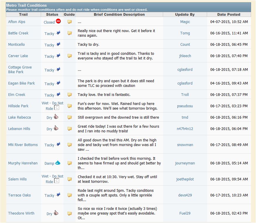
To prevent trail damage and erosion it is very important that mountain bikers avoid riding on wet trails.  Riding wet and closed trails creates ruts that take many volunteer hours to repair.  If you are unsure whether the trail you would like to ride is open or closed, MORC, Cuyuna Lakes MTB Crew, COGGS, MAMB and CROCT have made updated trail condition and closure information easy to find.  Be informed and never ride wet trails.  Your local trail work crew will thank you.

Twin Cities

http://www.morcmtb.org

MORC (Minnesota Off-Road Cyclists) has implemented several ways to keep on top of the latest mtb trail conditions in the Twin Cities area.  The first is the MORC Trail Conditions forum where updates are posted by MORC Forum members.


The MORC Trails app for IOS "Accesses the Minnesota Off-Road Cyclists website (morcmtb.org) to get the latest trail conditions for the local MORC trails. Let's the user customize the list of trails to follow, displays reported conditions based on how recently the condition report was submitted, and provides a trail detail page which shows the most recent report as well as providing links to the trail web page and conditions page."   The MORC Trails app is available for free at the App Store on iTunes.


And finally, the MORC @trailconditions Twitter account is updated from the MORC Trail Conditions Forum.

MORC Trail Conditions

http://www.2wheelweather.com/

The MORC Weather Blog put together by 2WheelWeather meteorologist and MORC member Kristin Clark is updated weekly with cycling weather in mind and how it will impact riders. "Where Cycling & Weather Come Together."  

Cuyuna Lakes

http://cuyunalakesmtb.com/


The Cuyuna Lakes Mountain Bike Crew regularly updates trail conditions via Twitter year round.  Know the trail conditions whether you want to "shred the red" or do some Winter fatbiking on the groomed trails here.


For more information on the trails at Cuyuna, visit cuyunalakesmtb.com.

Duluth 

http://wp.coggs.com/

C.O.G.G.S. (Cyclists of Gitchee Gumee Shores) updates trail conditions for several trails in the Duluth area via Twitter.  These include Hartley Park, Lester Park, Mission Creek, Mont Du Lac, Piedmont/Brewer and PokegamaSpirit Mountain is updated by the Spirit Mountain Twitter feed.

Hartley Park

Lester Park

Mission Creek

Mont Du Lac

Piedmont/Brewer

Pokegama

For more information on the trails in the Duluth area, visit wp.coggs.com.  More information about the Spirit Mountain Bike Park can be found by visiting spiritmtbike.com.

Mankato

http://www.mankatoareamountainbikers.org/

The Mankato Area Mountain Bikers update trail conditions for the Kiwanis and Ft. LeHillier on their Trail Maps & Conditions page.  Look for the Trail Conditions widget on this page.  Anytime the trails status is listed as "Wet", the trails are closed.

Northfield

http://croct.org/

CROCT (Cannon River Offroad Cycling Trails) manages the trails at Sechler Park and updates the trail conditions via Twitter.