Hiển thị các bài đăng có nhãn State Trails. Hiển thị tất cả bài đăng

Thứ Tư, 6 tháng 4, 2016

Resources for Planning a Minnesota Summer Biking Vacation


Summer is just around the corner and now is the time to start planning your Summer biking vacation(s).  With so many biking destinations around our great state you may want to get more information to help you decide where to go and where to stay.  There are so many resources available at your fingertips that planning your trip has become easier than ever.  Cities and regions around Minnesota are competing for your travel dollars this summer and they have made it easy to find more information about their destinations to attract you.


Minnesota has a lot to offer cyclists whether your discipline is road cycling, mountain biking, gravel, trail or bikepacking.  A great place to start is the Explore Minnesota website.  There is a lot of information here to help you plan the kind of rides you would like to take.  It contains an array of brochures that you can download, view online or have mailed to you.  Quite a few free regional brochures are listed for all areas of the state that can also be selected for mailing.  Go to the Explore Minnesota Travel Guides page to access these brochures.  There are also planning tools beyond just the website, Explore Minnesota Tourism staffs a travel information center with travel counselors that will help you with customized information (by phone, mail or e-mail) for planning your trip.

The 2015-16 Pedal MN Minnesota Biking Guide is another great place to start.  This free publication is available to view online, download or have mailed to you.  It is full of information on paved trails, on-road touring and mountain biking around the state.  It also contains links to trail maps, events and biking destination areas.  Another useful source of Minnesota cycling information is the Pedal Minnesota website that is filled with upcoming events, places to ride, trail information and trip planning resources.


If you have a destination in mind for your trip, try heading to the tourism or visitor's bureau website for that area or city.  Sites like Visit Duluth, Iron Range Tourism, Cuyuna Lake Chamber of Commerce and Root River Trail Towns are full of information that will help you find lodging, dining, attractions, events and area trails.  You may also visit my MN Tourism Resources page for a huge listing of online resources throughout the state.


The Minnesota DNR website contains all sorts of information on biking including State Trails, State Parks & Recreation Areas, State Forests, camping/lodging and other biking opportunities.  If you're looking to get off the beaten path, do some bikepacking or ride somewhere with great scenery, the DNR website is a great choice to get you started.


Summer is right around the corner, so use the wealth of information available on the Internet to make planning your next biking trip a breeze.  For easy to find trail maps and trail information for the Twin Cities Area, Southern MN, Central MN and Northern MN, don't forget about MN Bike Trail Navigator.  I have already done the research to find the links so you don't have to.

Chủ Nhật, 13 tháng 12, 2015

Singletrack Alternatives to Continue Riding During Freeze/Thaw Periods


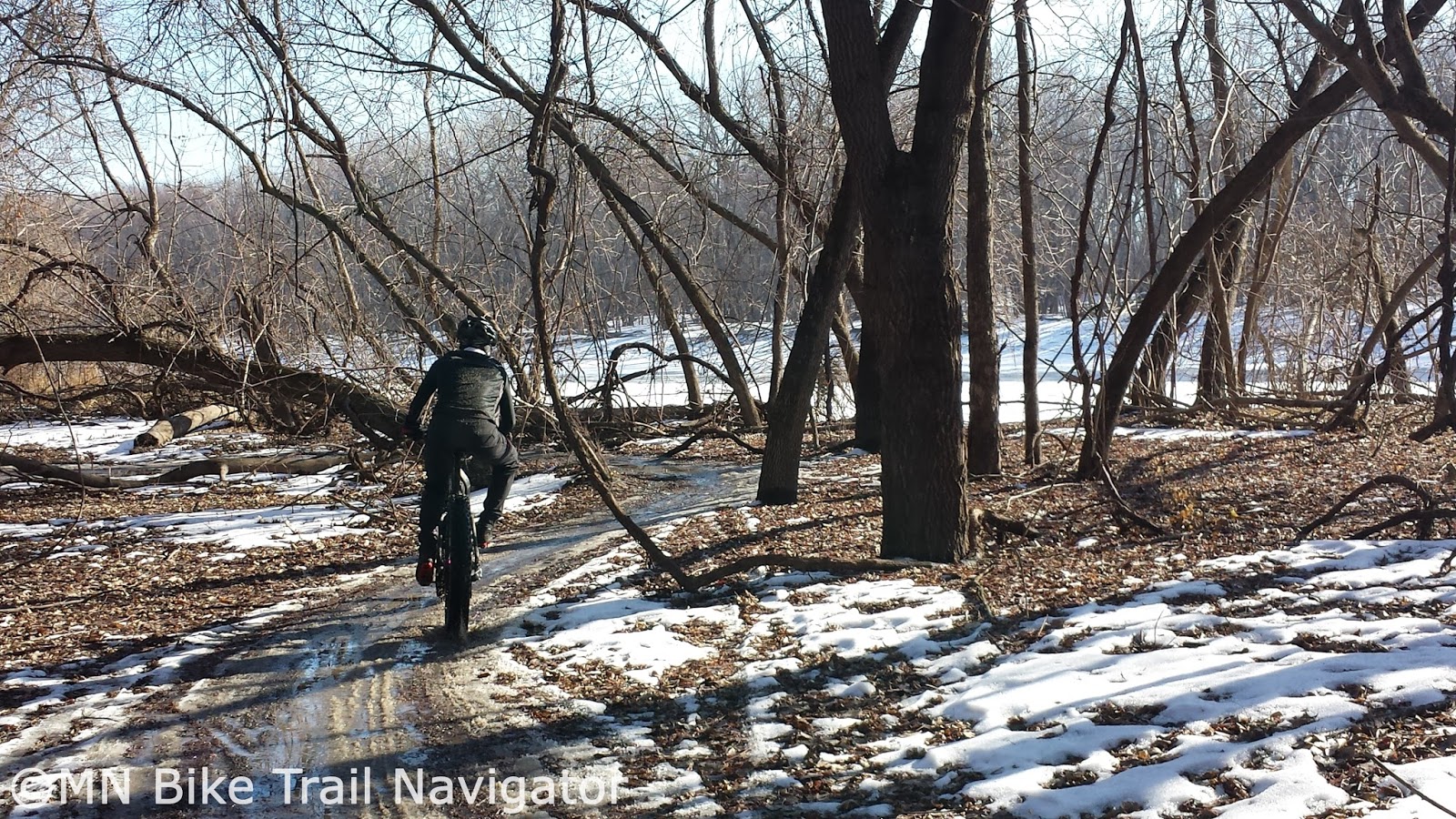
The unusually warm December weather we are experiencing has put us in a freeze/thaw cycle closing many of the singletrack trails around the state.  To keep the legs fresh and still get some miles in the saddle on a regular basis I have put together some places to ride until the snow comes offering us some groomed singletrack.

Gravel

If it's one thing Minnesota has plenty of it's gravel.  With an ever growing list of gravel rides and races throughout the year, you're sure to have plenty of route options following one of these courses. If you're new to gravel, Gravelmap.com will help you find roads to ride.  I have also posted some of my favorite gravel rides on MN Bike Trail Navigator complete with maps, cue sheets, gpx file download links and Strava route links.  Gravel never closes and is a great way to get in some miles with varied terrain and climbing.

Aggregate Trails

Minnesota has several aggregate trails that are similar to riding gravel.  Most are built on former railway beds so there won't be much elevation change but they will allow you to get in some miles, none the less.  Some of these include the Luce Line State Trail, Minnesota River Bluffs LRT Regional Trail, Lake Minnetonka LRT Regional Trail.

State Trails

Several of Minnesota's State Trails have a natural surface treadway suitable for horseback riding or mtb/fatbike use.  If sharing the trail with horseback riders please use proper trail etiquette.  These trails include:

 
River Bottoms Bushwacking

River bottoms floodplains have some great riding opportunities.  Two of the areas I have done some "bushwacking" are the Vermillion River Bottoms and the Minnesota River Bottoms.  Bushwacking is riding through areas where there is no trail and river bottoms floodplains are a great place to do this.  Fall and early Winter are great times to ride these areas of flat wooded expanses.


The Mississippi National River & Recreation Area near Ravenna TWP southeast of Hastings along the Vermillion River is definitely worth exploring.  The Minnesota River Bottoms is also a good place to roll through floodplain forests and fields.  Respect the area you ride and remember to leave no trace.

Forest Service/Logging Roads
Image Credit: Joe Sacco

The Chippewa National Forest and Superior National Forest have plenty of Forest Service roads, logging roads and unpaved trails with some beautiful scenery to be explored.  Some of these areas are remote so make sure you have everything you need to get you out of a jam and back to where you started.


State Forests
Image Credit: Joe Sacco

Minnesota State Forests are also full of riding opportunities.  These opportunities include non-motorized trails, multi-use trails, State Forest roads, Minimum Maintenance Forest Roads and OHV/ATV trails.  Below are links to maps and more information on these State Forests.

Southern MN State Forests


Central MN State Forests

Northern MN State Forests
Pillsbury State Forest     Map       

The Minnesota DNR reminds you, when biking in State Forests:
  • Mountain biking is permitted on all state forest roads and trails unless posted closed with the exception of Richard J. Dorer Memorial Hardwood State forest, where mountain bikes are permitted only on designated trails.
  • State forest roads can range from asphalt to gravel, maintained to minimal maintenance road surfaces.
  • Forest roads are used by cars, logging trucks, and other forest users (hikers, hunters, horseback riders, ATVs, and off-highway motorcycles).
  • All laws for public road use must be followed on state forest roads.
  • Watch out for logging trucks and heavy equipment in a state forest.
  • Check the state forest maps and Web site for road and trail closures.
  • Share the trail with others.
  • Stay on designated trails.
  • Keep right so others can pass.
  • Keep all pets on leash.
  • Obey traffic signs and rules.
  • Pack out all garbage and litter.
  • Respect adjoining landowners’ rights and privacy.
  • Warn other trail users when passing by giving an audible signal.
  • Let horses know you are passing. Some may be spooked by quiet bikers or inline skaters.
  • Overnight camping and campfires are permitted only on designated campsites.
  • Do not leave campfires unattended.
  • Enjoy the beauty of wild plants and animals, but leave them undisturbed for all to enjoy.
For more information on mountain biking in Minnesota State Forests, see my post, Explore Minnesota's State Forests by Mountain Bike With Resources From the MN DNR.

To order a State Forest map, contact the Minnesota DNR Information Center.

Phone:  651-296-6157 or 888-646-6367
Email:   info.dnr@state.mn.us
Address:  500 Lafayette Road
St. Paul, MN 55155-4040

Paved Trails

Paved trails are always open and many of them in Minnesota have some great scenery.  For a list of trails throughout the state of Minnesota with links to more information and maps visit the appropriate MN Bike Trail Navigator trail links page for your area.


MN Fatbike Enthusiast Recommendations 

I received several recommendations from MN Fatbike Enthusiasts Facebook Group members when posed with this question "...places to ride for mountain bikers/fat bikers during this freeze/thaw period that we are in. With the trails closed, where are you guys riding to get miles in?

"7 mile creek park in Nicollet county...located off Hwy 169 between Mankato and St. Peter. Their multi-use trails have gravel and are always open." - Clay Haglund

"Road bike on the trackstand, and fat-bike at Wayside Prairie and Dalbo Memorial Forest County Parks. Both dry off quickly after rain do to heavy pine cover." - Hans Erdman

"The MRT trails in St. Paul along the river. I've been doing lots of 'urban exploring'. I've also ridden some gravel out towards Rosemount." - Tony Lema

"All early morning rides...... Forest road/woods/mining areas, frozen gravel. Paved trails..... anywhere but established sweat earned single track goodness.... that will come next week!!" - Joe Sacco

"Gateway Trail heading towards Pine Point park (don't ride in Pine Point). Lots of horse trail and singletrack there . All sand and good water wicking dirt and back." - Papito Gregorio

"Soo Line Recreation Trails in Central MN. (Approxiately 50 miles one way of trail). Lots of minimum maintenence roads that connect to these trails. Several county parks, forests, and some state trails. Check out Stearns County Recreational Trails for a list of fat bike friendly locations. I would suggest get a hold of your local bike shops, trail advocates, and bike clubs for a complete list of fat bike friendly routes. Then there is lots and lots of gravel roads winding through the country side. Several turn into minimum maintenance roads. Get up to Central MN and "get your fat on"." - Theresa Gregory

Hopefully this post will give you some ideas of where to ride so you can keep getting miles of riding enjoyment in until the singletrack trails open once we get some snow and below freezing temperatures.

Thứ Tư, 30 tháng 9, 2015

Fall is the Perfect Time of Year to Experience the Central Lakes Trail

Image Credit: MN DNR

Fall is the perfect time to take a ride on the Central Lakes Trail.  This former railway bed is a 55 mile paved trail that travels through ten communities in west-central Minnesota.  Riders will experience the cooler weather and Fall colors as they pass by the woods, wetlands and lakes between Fergus Falls and Osakis.


Below are video previews from the MN DNR highlighting each segment of the Central Lakes Trail to help you plan your ride route. The Central Lakes Trail Association also has a detailed trail description page that uses trailside markers developed from old Burlington Northern Railroad mile markers.

Fergus Falls to Dalton
10 miles


Dalton to Ashby
5 miles

Ashby to Melby
4 miles

Melby to Evansville
5 miles

Evansville to Brandon
6 miles

Brandon to Garfield
6 miles

Garfield to Alexandria
8 miles

Alexandria to Nelson
 5 miles

Nelson to Osakis
6 miles

The Central Lakes Trail map is available for download from the MN DNR and the Central Lakes Trail Association.  Visit CentralLakesTrail.com for more information and links to lodging and bike rentals along the trail.  Get out and enjoy the beautiful gem known as the Central Lakes Trail.

Thứ Ba, 23 tháng 12, 2014

New Fatbike Trails Opening Up Around Minnesota


With the ever-increasing popularity of fatbikes, Winter trail access in Minnesota is growing.  The Minnesota DNR issued a News Release last week adding 58 new miles open to fatbiking in Minnesota State Parks and on State Trails.  These are not the only new places to ride in Minnesota this Winter, more are popping up around the state.

Twin Cities Area

The City of Golden Valley has partnered with the Three Rivers Park District and will groom two multi-use trails at Brookview Golf Course that will be open to fatbiking.  Trail lengths will be 3/4 mile and 3 1/2 miles of unlit corduroy that will be maintained through late February.  The Brookview Grill will be open for food and cocktails Friday through Sunday until February 16th.  For more information see my post Brookview Golf Course Opens to Fatbikes This Winter.

Lake Elmo Park Reserve has 2.5 miles on the Big Bluestem Trail that will be packed multi-use and includes fatbiking.  A Washington County Parks Vehicle Permit is required on all vehicles entering the park.  More information can be found in the Washington County Parks Winter Trails-Lake Elmo Park Reserve Brochure.


Cleary Lake Regional Park in Prior Lake grooms trails for cross-country skiing and according to Explore Minnesota it also has a "fat tire" trail with bike rentals available during the winter.  Call Cleary Lake Regional Park (763-694-7777) for more information.


As part of the announcement from the Minnesota DNR last week, Fort Snelling State Park has added 6 new miles of packed multi-use trails.  The Luce Line State Trail is groomed for multi-use including fatbiking from Vicksburg Lane to Stubbs Bay Road.  The Gateway State Trail is plowed from Cuyuga Street to Jamaca Avenue opening up 11.9 miles of trails to all winter biking.


Southern MN

CROCT (Cannon River Offroad Cycling and Trails) opened their first mtb trail at Sechler Park in Northfield on November 15th.  The 1.2 mile two-way singletrack runs through the wooded floodplain along the Cannon River and is open to Winter biking.  For the latest trail conditions follow @CROCTconditions on Twitter.

Sechler Park River Bottoms Trail

The Mankato Area Mountain Bikers (MAMB) have finished the two loops of mountain bike trails at the Kiwanis Recreation Area and they are open for Winter fatbiking.  The short loop is a 1 mile beginner-rated trail and the long loop is a 4 mile intermediate-rated trail.  For updated trail conditions at the Kiwanis MTB Trail, visit the MAMB Facebook page.

Kiwanis Mountain Bike Trail

The Winona Area Mountain Bikers (WAMB) will be grooming the trails at the top of Cherry Hill and portions of Holzinger Lodge this Winter.  According to a post on the MORC Trail Conditions Forum for Holzinger Lodge, "WAMB has come to an agreement with the City of Winona to groom portions of the trail that are accessible by snow machine. This will include the Low Rollers and the Wildwood Loop at the top. Cistern, Horse Trail and Quarry will not be groomed due to the rough terrain."  For updates on these two trails, visit the WAMB Facebook page.

The Minnesota DNR has opened 13 miles of groomed trails from Pine Island to Rochester on the Douglas State Trail to fatbiking as well as 6 miles of groomed trails at the Blazing Star State Trail/Myre-Big Island State Park.


Central & Northern MN

Isanti County Parks has added over 15 miles of multi-use (hiking, snow shoeing, fat tire biking or cross country skiing) groomed trails this Winter.  These include 5 miles at Springvale County Park, 3 miles at Becklin Homestead County Park, 3 miles at Irvin and John Anderson County Park, 2 miles at Vegsund Family County Park and 2 miles at Wayside Prairie County Park.  For the latest trail conditions, visit the Isanti County Parks Facebook page or call 763-689-8220.


Image Credit: Stearns County Parks
Stearns County Parks has opened up fatbiking on its multi-use (Winter Walking/Dog Walking/Snowshoeing/Fat Tire Biking) trails in five parks. These parks include Kraemer Lake–Wildwood County Park, Lake Koronis Regional Park, Mississippi River County Park, Quarry Park & Nature Preserve and Warner Lake County Park.  For more information contact Stearns County Parks at 320-255-6172 or by email at parkinfo@co.stearns.mn.us.

Soo Line West
Soo Line East


The Morrison County Board of Commissioners recently reviewed its rules for recreational trails including the use of fatbikes.  The Recreational Trail Rules and Regulations Ordinance that will affect the Soo Line East and Soo Line West trails would allow snowmobiling, fat-tire bicycling and cross country skiing from December 1st through March 31st as long as there is snow cover of three or more inches on the trail.  This will provide 36 miles of trail for fatbiking.  The ordinance also states “the trail is closed and may not be used for any purpose (hiking, biking, skiing, ATVing or snowmobiling) from Nov. 1 through Nov. 30 of each year.”  For more information or questions regarding the use of these trails should contact the Morrison County Public Works Department at 320-632-0121.

COGGS (Cyclists of Gitchee Gumee Shores) will be grooming six miles of newly completed trails at Mission Creek and “purposeful snowshoeing” the trails at Brewers Park in Duluth to pack the trails for fatbike riding.  Brewer Park consists of Brewer Park (beginner), Homebrew, Lollygagger and Kissing Booth and links up with Piedmont across Haines Road.  For trail conditions at Mission Creek visit @COGGSMissionCrk and Piedmont/Brewer Park visit @COGGSPiedmontTC.

Maplelag Resort in Callaway announced last week it will have their snowshoe trail and the three miles of Twin Lakes Singletrack packed and open for fatbiking.  Forest roads in the area will also be another option for fatbike riding.  For more information or questions contact Maplelag Resort by calling them at 218-375-4466 or sending an email to maplelag@tvutel.com.


The Minnesota DNR has 20 miles of groomed trails at Cuyuna Country State Recreation Area.  New trails include 5.4 miles of groomed trails at Jay Cooke State Park and 8.7 miles of groomed trails for fatbikes and ski skating at Split Rock Lighthouse State Park.


Remember to always follow IMBA's Fat Bike Best Practices and help give our sport a good name to gain more trail access in the future.

Thứ Ba, 16 tháng 12, 2014

MN DNR Issues News Release on New Fatbike Riding Opportunities

Minnehaha Trail-Fort Snelling State Park
Image Credit: Bonnie Moebeck


The Minnesota DNR issued a News Release on December 15th that details the expansion of fatbike riding opportunities throughout the state.  These opportunities include 58 new miles open to fatbiking in Minnesota State Parks and on State Trails.  This is in addition to the 20 miles already in use at Cuyuna Country State Recreation Area near Ironton.  Minnesota State Parks and Trails has also implemented a Winter Fat Biking Pilot Project to assist in finding places to ride and they would also like rider feedback that includes comments, suggestions and ways to improve these new winter fatbike trails.

The Minnesota DNR has maps of these new fatbike-friendly trails available for download.  These maps clearly detail fatbike/multi-use trails from snowshoe/ski/hiking only trails through the use of color to distinguish use (see each map's legend).

Image Credit: Minnesota DNR

In Northern Minnesota, Cuyuna Country State Recreation Area has 20 miles of groomed trails, Jay Cooke State Park has added 5.4 miles of trails to be groomed and Split Rock Lighthouse State Park will groom 8.7 miles of trails for fatbikes and ski skating.

Twin Cities Metro Area fatbike trail opportunities include Fort Snelling State Park with 6 miles of packed muti-use trails, the Luce Line State Trail has 7 miles of groomed multi-use trails and the Gateway State Trail is plowed from Cuyuga Street to Jamaca Avenue opening up 11.9 miles of trails to all winter biking.

In Southern Minnesota there are 13 miles of groomed trails from Pine Island to Rochester on the Douglas State Trail and the Blazing Star State Trail/Myre-Big Island State Park has added 6 miles of groomed trails.

Image Credit: Jake Hawkes/IMBA

Other opportunities for fatbiking from the MN DNR include:

Winter fat biking is allowed on trails that are signed and identified on DNR maps as open to fat biking, such as:

  • State forest roads or trails that are identified as allowing bicycling, unless they are groomed and tracked for cross-country skiing or snowmobiling only.*
  • State park and state recreation area trails designated for bicycling, including some non-motorized multi-use trails that may be shared with skiers, walkers, or snowshoers, unless they are groomed and tracked for cross-country skiing or snowmobiling only.*
  • State park roads, where motor vehicles are allowed, except those posted closed for biking.
  • State trails, except those groomed and tracked for cross-country skiing or snowmobiling only.
*NOTE: Most ski and snowmobile trails do not allow other uses. Skier and snowmobiler user fees pay for grooming and maintenance.

Areas to avoid riding fatbikes from the MN DNR:

While groomed snowmobile and ski trails can be an appealing ride option, most of those types of trails are not open to other uses due to concerns regarding safety and trail grooming costs that are paid through user fees. Please remember to be thoughtful and courteous as you seek out opportunities to enjoy the sport of winter fat biking.
Winter fat biking is not allowed on:

  • Most snowmobile trails, including the grant-in-aid (GIA) trail system. As a general rule for everyone's safety, please avoid fat biking on any snowmobile trail.
  • Most groomed and tracked cross-country ski trails, which are for skiing only
  • Any trail that is not specifically identified as open for bicycling, including hiking or snowshoeing trails in state parks or state recreation areas.

For more information on where to ride fatbikes in Minnesota, contact the DNR Information Center at info.dnr@state.mn.us or 651-296-6157 or 888-646-6367 between 8 a.m. and 4:30 p.m. Monday through Friday.

Remember to always follow IMBA's Fat Bike Best Practices.

Thứ Tư, 10 tháng 9, 2014

Best Times and Places For Fall Color Rides With Help From the MN DNR

Image Credit: MN DNR

Fall is one of my favorite times of the year for bicycling and the Minnesota DNR has several tools available to help you experience the color changes throughout the state.  The Minnesota Department of Natural Resources Fall Color Map has now gone live and will be updated by State Park and State Recreation Area (SRA's) staff by noon every Thursday.  With the wet Spring Minnesota has had and a good growing season during the Summer, trees are very healthy and a magnificent color display is expected throughout the state now through mid-October. 

To coincide your bike rides with the peak color changes using your smartphone or tablet, the MN DNR also has a Fall Colors Mobile version that is integrated with Google Maps.  It will display a map for typical peak colors around the state and provide a list view or  map view of State Park and SRA's with percentage of color change.  Click on any listing for more details on where to go, what you'll see and other things of interest.  Each listing also has links to events, a map view and the corresponding MN DNR webpage.

Minnesota has 24 State Trails with scenic views to check out the fall colors.  Whether you prefer to ride on paved, aggregate or natural surface trail, there are many miles to explore.  Visit the Minnesota State Trails Start Up Guide to pick a trail that is right for you.

I published a four part series of posts entitled "Favorite Trails for Fall Color Rides" two years ago that list some of my favorite places to ride during the Fall.  These are some really fun trails with great scenery.  They can be read at the following links:  Part 1, Part 2, Part 3 and Part 4.  Give them a try, they will not disappoint.

Image Credit:  MN DNR
If adventure riding or forest roads are a little more your style the Minnesota DNR has a page with information about biking in Minnesota State Forests.  There are over 2000 miles of forest roads and thousands of logging trails to explore.  See my post Explore Minnesota's State Forests by Mountain Bike With Resources From the MN DNR.

Fall is a wonderful time of year for biking and with a little help from the MN DNR you can find out where and when to go for a great riding experience.

Thứ Tư, 7 tháng 5, 2014

Resources To Help You Plan Your Minnesota Summer Biking Trips

Root River State Trail
Now that the weather is beginning to warm up and summer is fast approaching, you may be thinking about planning your Minnesota biking trip(s).  With so many biking destinations around our great state, you may want to get more information to help you decide where to go and where to stay.  There are so many resources available at your fingertips that planning your trip has become easier than ever.  Cities and regions around Minnesota are competing for your travel dollars this summer and they have made it easy to find more information about their destinations to attract you.

Willard Munger State Trail

A great place to start is the Explore Minnesota website.  There is a lot of information here to help you plan the kind of rides you would like to take.  It contains an array of brochures that you can download, view online or have mailed to you.  Quite a few free regional brochures are listed for all areas of the state that can also be selected for mailing.  Go to the Explore Minnesota Travel Guides page to access these brochures.  There are also planning tools beyond just the website, Explore Minnesota Tourism staffs a travel information center with travel counselors that will help you with customized information (by phone, mail or e-mail) for planning your trip.

Red Jacket Trail

One brochure you may find particularly useful is the 2013/2014 Explore Minnesota Biking Guide.  It contains maps of bike trails, trail information by region (Southern, Central, Northeast, Northwest and Twin Cities area), on-road touring and information about Minnesota's best mountain biking destinations.  The Trail Listings segment informs you about the trails, area businesses and scheduled monthly bike rides complete with website links to bring you more details.  Another useful source of Minnesota cycling information is the Pedal Minnesota website that is filled with upcoming events, places to ride, trail information and trip planning resources.

Lake Wobegon Regional Trail

If you have a destination in mind for your trip, try heading to the tourism or visitor's bureau website for that area or city.  Sites like Visitduluth.com, Minneapolis.org, Cuyunalakes.com and Lanesboro.com are full of information that will help you find lodging, dining, attractions, events and area trails.  Visit my MN Tourism Resources page for a huge listing of online resources throughout the state.

Afton State Park

Minnesota has an abundance of State Parks with scenic trails for biking, mountain biking and hiking.  These State Parks are scattered throughout Minnesota and chances are there is one near you or your vacation destination.  The Minnesota DNR provides a lot of information on it's website about our State Parks and all they have to offer.  Go to the Minnesota State Parks page to find out more.

Summer is right around the corner, so use the wealth of information available on the internet to make planning your next biking trip a breeze.  For easy to find trail maps and trail information for the Twin Cities Area, Southern MN, Central MN, Northern MN and MN MTB Project Trails, don't forget about MN Bike Trail Navigator.  I have already done the research to find the links so you don't have to.